


 |
 |
 |
 |
 |
 |
EMISSARY MAP
This map was transmitted to the Central Secretariat of the movement Gordonia in Rumania by the emissary from Poland who visited Polish cities and also Galicia in order to establish contact with the remnants of the members of that movement. The map was prepared by him in Poland. It was drawn according to specifications by the secretaries of Gordonia in Rumania. It was finally sent to the secretaries of the kibbutzim organisation in Palestine. Signed: Chief Secretary of Gordonia in Rumania, September 1943 Source: Julius Kuhl Collection, Wiener Library |
 |
ONE OF THE FIRST MAPS
|
 |
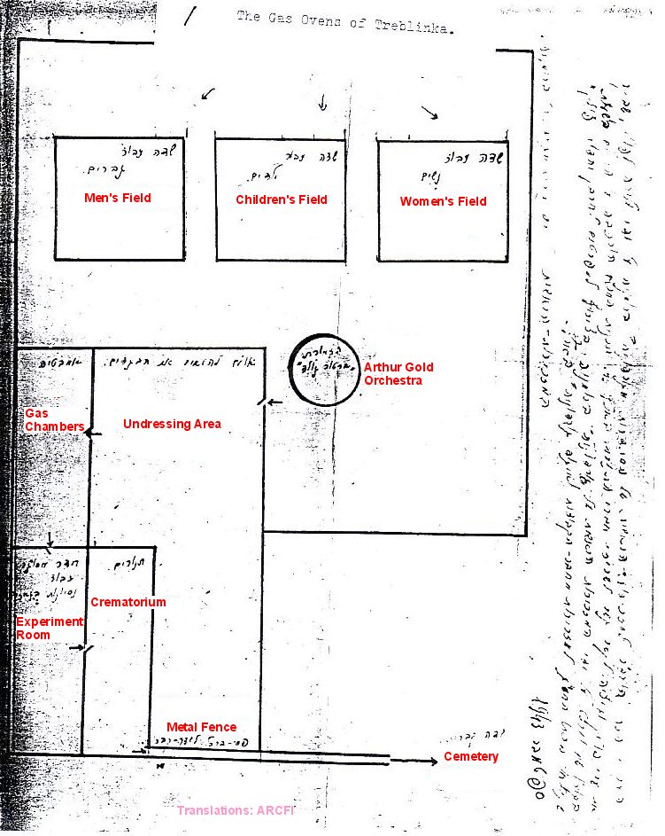
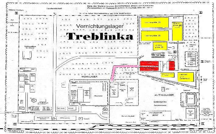
WIERNIK MAP #1
Plan of the extermination area of Treblinka, drawn in 1944 by survivor Yankiel Wiernik. |
 |
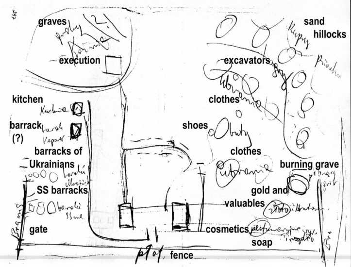
WIERNIK MAP #2
Plan of Treblinka, drawn in 1945 by survivor Yankiel Wiernik. From: Filip Friedman, This was Oswiecim!, The United Jewish Relief Appeal, London 1946, p. 81-84. |
 |
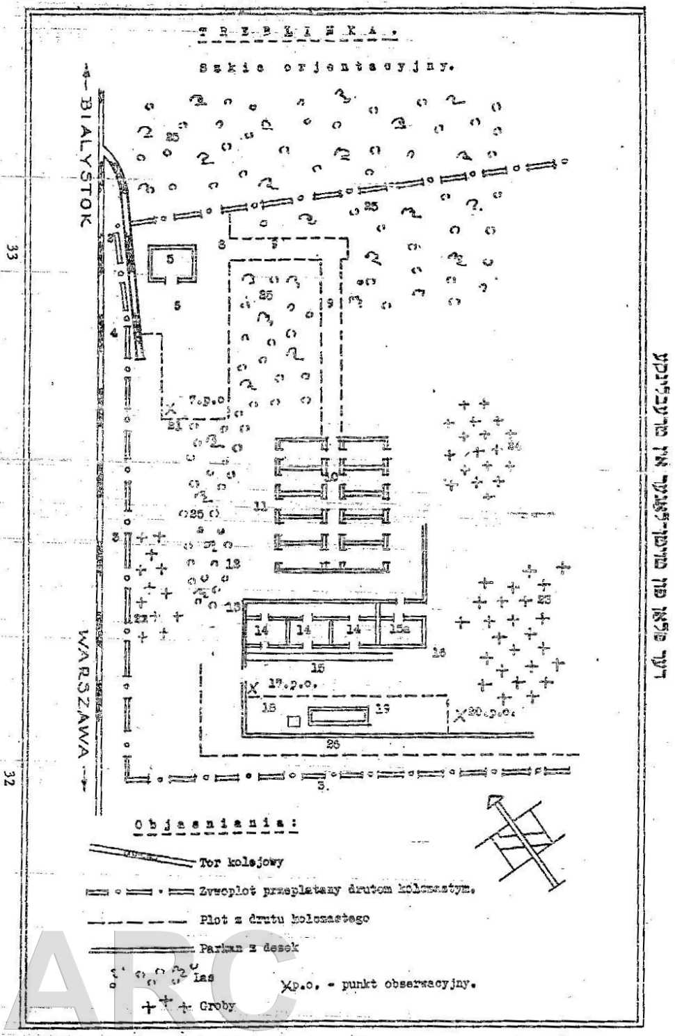
SURVEY MAP 1945
|
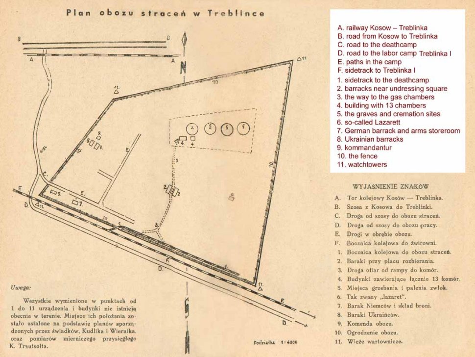 |
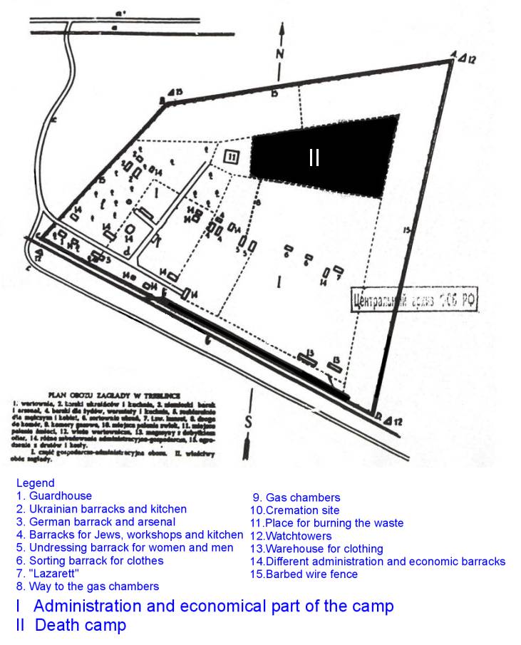
KUDLIK, WIERNIK, TRAUTSOLT MAP
One of the first maps, drawn by survivors in 1945. One of the only survivor maps which - regarding the shape - corresponds with the site as it appears today as well as aerial photo evidence. Source: Zdzislaw Lukaszkiewicz. Oboz stracen w Treblince. PIW, Warszawa 1946. |
 |
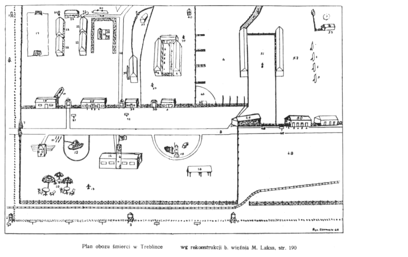
KUDLIK, LAKS, PLATKIEWICZ MAP
Improved version of Kudlik's first map, from 1945. |
 |
1946 MAP
Treblinka map drawn in 1946 by survivor Moszek Laks, named "Mietek". |
 |
GLAZAR MAP
Richard Glazar was member of the camouflage commando with a keen eye for detail. His map is basically the same as three other maps and contains some discrepancies in the placing of featured as well as the overall shape of the camp. The extermination site ("Upper Camp") was not known to him and is therefore not reliable in its detail. Click here for the Treblinka model according to Mr. Glazar's remembrance. Click for the interactive map |
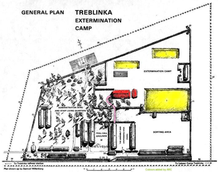 |
WILLENBERG MAP
Samuel Willenberg was part of the camouflage commando who had access to most of the camp, except for the extermination area. He included every detail to scale - and being an excellent draughtsman - his map of the camp may be considered as one of the most reliable regarding the scaling of its features. However the extermination area for instance was also not known to him and is therefore not reliable. The outer shape of the camp resembles almost the actual site's shape. |
 |
SKETCH #1
General layout of the camp, sketched for Oneg Szabat, the underground archive of the Warsaw ghetto. This map was drawn by a Czestochowa resident, who managed to escape from Treblinka, returned to Czestochowa in October 1942 and informed the people of the death camp. Nobody believed in his story. The author could have been a certain Brokman or Henrik Sperlin. Both were deported to Treblinka in September. They may have even been on the same train, and possibly escaped together. |
 |
SKETCH #2
General layout of the camp, sketched for Oneg Szabat, the underground archive of the Warsaw ghetto. This map was drawn by a Czestochowa resident, who managed to escape from Treblinka, returned to Czestochowa in October 1942 and informed the people of the death camp. Nobody believed in his story. The author could have been a certain Brokman or Henrik Sperlin. Both were deported to Treblinka in September. They may have even been on the same train, and possibly escaped together. |
 |
SKETCH #3, WITH LEGEND
General layout of the camp, sketched for Oneg Szabat, the underground archive of the Warsaw ghetto. This map was drawn by a Czestochowa resident, who managed to escape from Treblinka, returned to Czestochowa in October 1942 and informed the people of the death camp. Nobody believed in his story. The author could have been a certain Brokman or Henrik Sperlin. Both were deported to Treblinka in September. They may have even been on the same train, and possibly escaped together. |
 |
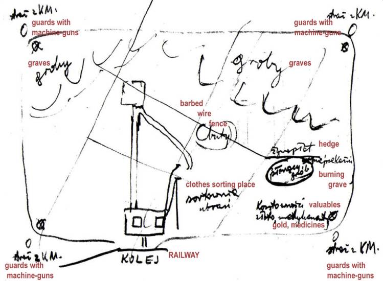
KRZEPICKI MAP
Jakub Abraham Krzepicki was deported to Treblinka on 25 August 1942. 18 days later he could escape, hiding himself in clothes which were sent back to Lublin in a freight car. |
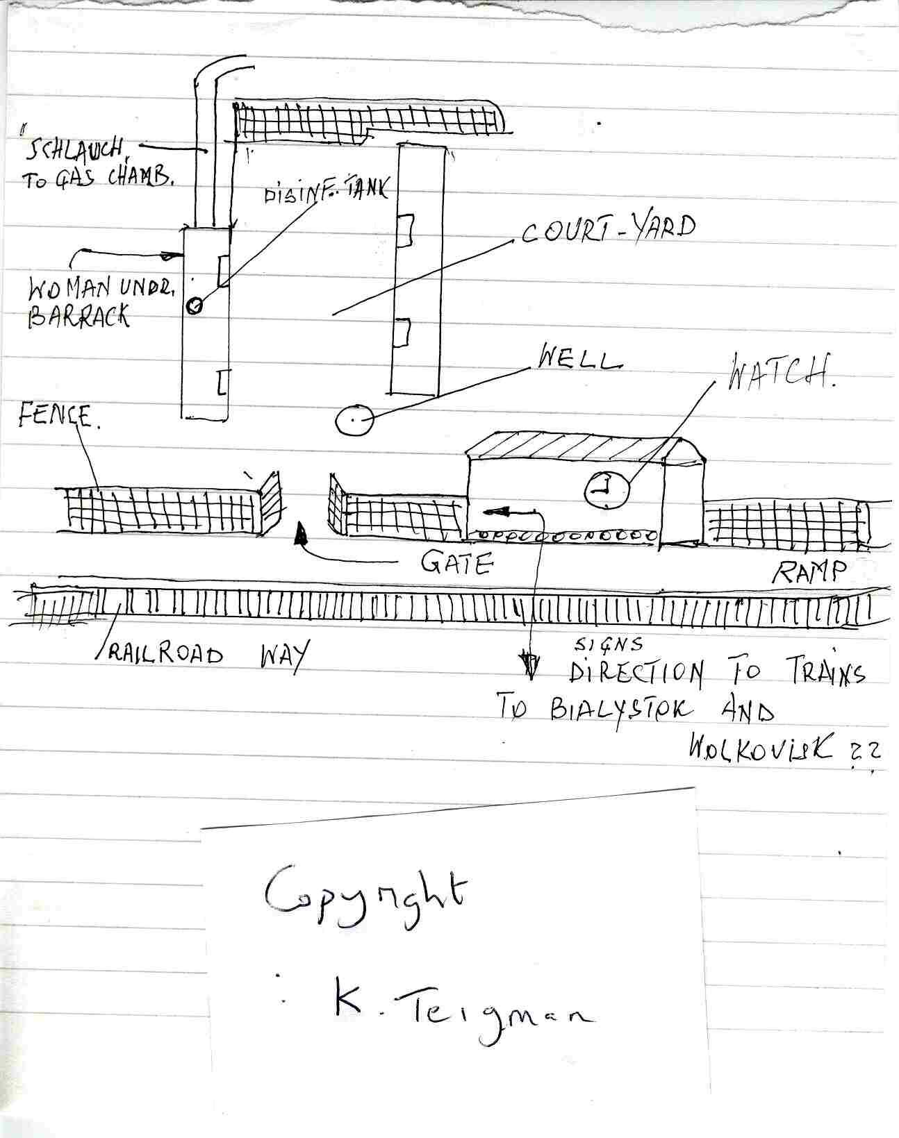 |
TEIGMAN SKETCH
Survivor Kalman Teigman drew this sketch of the "station" and the undressing facilities. |
 |
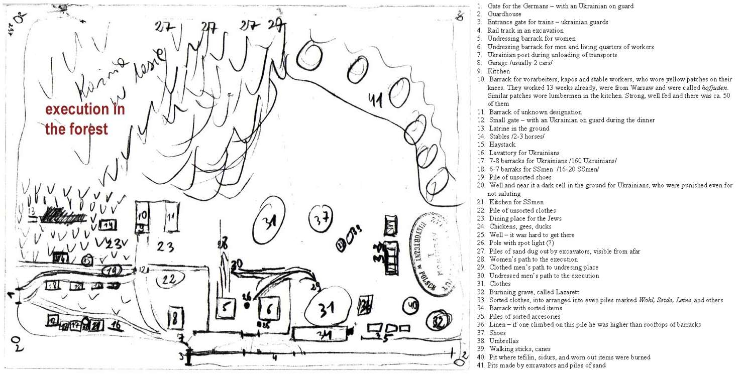
WIERNIK-MODEL MAP
Survivor Jacob Wiernik was a carpenter, most of his time restricted to the extermination area. He made a model of the camp and it's features of which this map is a stylised version. The model gives us a unique insight into the layout of the extermination area. |
 |
TREBLINKA TRIAL MAP
This map was drawn and used as evidence against the Lager- Kommandant Franz Stangl, during the Second Treblinka Trial in 1970. Stangl declared this plan to be "absolutely correct". There are a number of interesting smaller details in the Stangl map which does not appear in other maps such as placing of trees, gates, cellars etc. (A rough camp map as drawn by his deputy Kurt Franz is also available, mainly showing the areas where staff was on duty. See "SS-Perpetrators"!) |
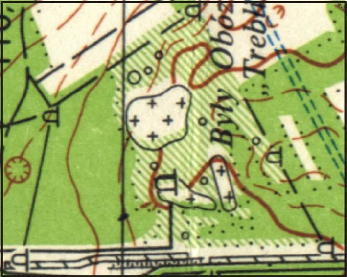 |
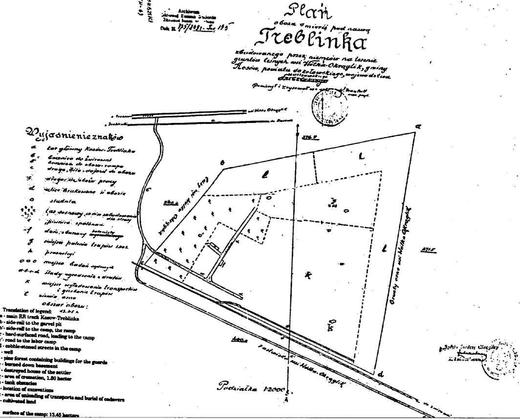
TOPOGRAPHICAL MAP
Official Polish topographical map of the deathcamp site as it appears today. The perimeters of the camp correspond in general with the Survey Map of 1945 as well as the aerial photos. The monument, which is apparently erected nearly the spot where the New Gas Chambers stood, is indicated as well as the area where some of the mass graves were located. Naturally contouring of the area is also shown. |
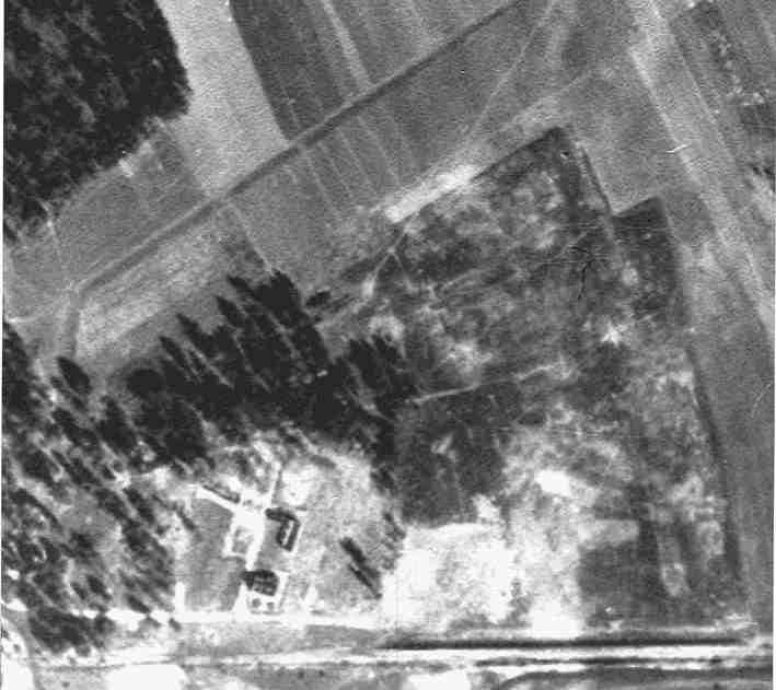 |
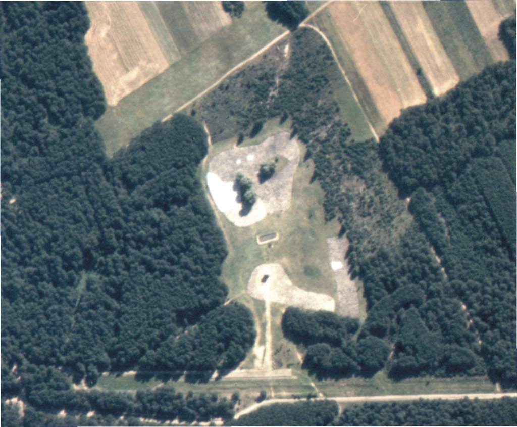
1944 AERIAL PHOTO
Aerial photo of the remains of the Treblinka camp taken in September 1944 (i.e. ± 11 months after the dismantling of the camp) and after attempts at disguising the site as a farm. Scarring of certain features are impossible to eradicate and can still be discerned. From this a calculated reconstruction for the New Treblinka Map is attempted but in certain areas the position of features and fencing still remains unsolved. Source: Aerial Photos from the National Archives, Washington DC. |
 |
1944 DRAWING
This impressive drawing is based on a 1944 aerial photo, taken by the German Luftwaffe. The artist Arie A. Galles created this drawing. It is part of his work of art suite "Fourteen Stations/Hey Yud Dalet", exhibited at the Morris Museum in Morristown, New Jersey. See the artist's website: http://fermi.phys.ualberta.ca/~amk/galles/index.html |
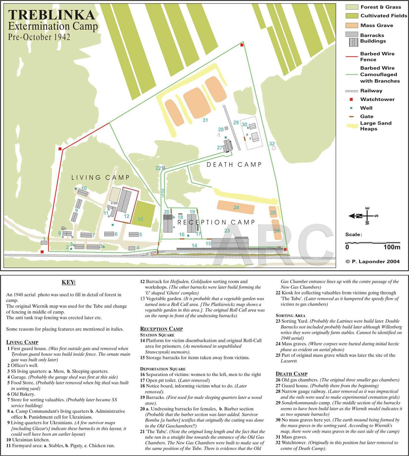 |
NEW TREBLINKA MAP PRE-OCTOBER 1942
This is probably the first map of the camp in which the features are drawn to scale (as close as possible) and the actual shape and size of the camp taken into consideration. Note: The map is intended to show how the camp was in a constant development and improvement. Although the map was drawn, taking several testimonies in consideration, it is not accurate as evidence of the appearance of the camp at that time is too sketchy. Copyright: P. Laponder. |
 |
NEW TREBLINKA MAP AUGUST 1943
The proposed new map as discussed in more detail in the section of the camp's features. This is probably the first map of the camp in which the features are drawn to scale (as close as possible) and the actual shape and size of the camp taken in consideration. Note: This redrawn map should by no means be considered as an exact representation of the camp - this would never be entirely possible. There are simply too many discrepancies in all of the maps and witnesses' reports (due to causes as explained in points above). Copyright: P. Laponder |
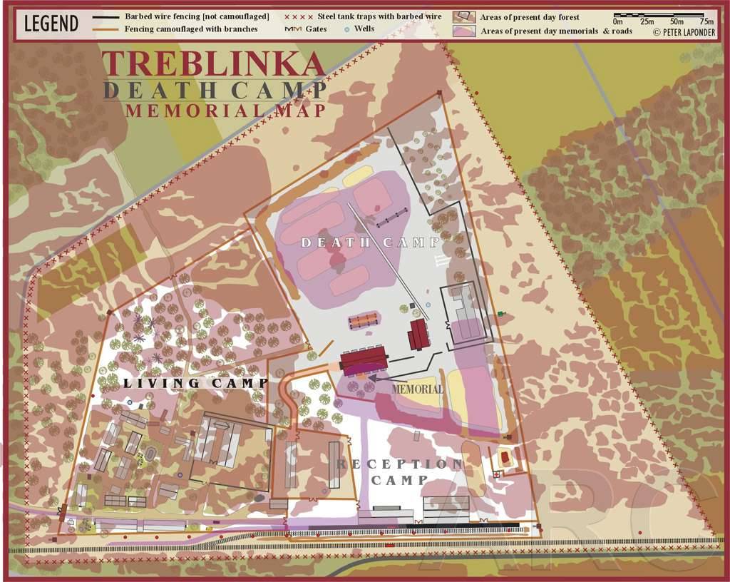 |
NEW TREBLINKA MAP WITH MEMORIAL
This is probably the first map of the camp in which the features are drawn to scale (as close as possible) and the actual shape and size of the camp taken into consideration. Note: This redrawn map should by no means be considered as an exact representation of the camp - this would never be entirely possible. Copyright: P. Laponder. |
 |
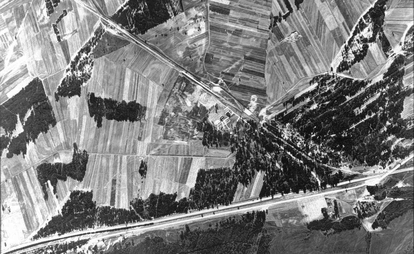
TODAY'S AERIAL PHOTO
|
 |
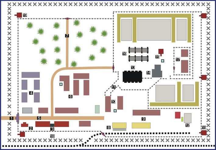
INFORMATION SIGN FOR VISITORS
|